manturs.narod.ru
confluence.org

К моим визитам


20-февраля-2026 – При планировании лыжного похода на плато Маньпупунёр обнаружилось, что в двух километрах от нашего маршрута находится непосещённая точка конфлюенции 62N-60E. Решили зайти.
Первые 700 метров от снегоходной дороги – редкий лесу с глубоким снегом. На озере Маньялбынтур – хороший наст, высокая скорость. Последний километр до цели шли по густому лесу с подлеском и глубоким снегом. На этот участок пути затратили 2 часа. В лесу очень неустойчивая связь со спутниками. Трудно было найти точное слияние. После посещения продолжили маршрут. От точки до плато по прямой 46 км. Фактически мы прошли на лыжах 96 км.
Плато Маньпупунёр – уникальный геологический памятник на Северном Урале, знаменитый семью столбами выветривания высотой 30–42 метра. По легенде манси, это окаменевшие великаны, пытавшиеся уничтожить местное племя.
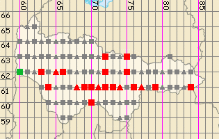
Точка расположена в Берёзовском муниципальном районе Ханты-Мансийского автономного округа. В 6,8 км на северо-восток расположен маленький мансийский посёлок Турват. На старых картах он обозначен как «юрты Саклингъя». Местность таёжно-болотная. Предгорья Уральского хребта.
20-Feb-2026 – Whilst planning a ski trip to the Manpupuner Plateau, we discovered that the unvisited 62N-60E confluence point lay just two kilometres from our route. We decided to pay it a visit.
The first 700 metres from the snowmobile track were through sparse woodland with deep snow. On Lake Manyalbyntur, the snow cover was good and we made good speed. We covered the final kilometre to our destination through dense forest with undergrowth and deep snow. This section of the journey took us two hours. Satellite reception was very patchy in the forest. It was difficult to pinpoint the exact confluence. After visiting it, we continued on our route. The distance in a straight line from the starting point to the plateau is 46 km. In fact, we skied a total of 96 km.
The Manpupunyor Plateau is a unique geological site in the Northern Urals, famous for its seven weathering pillars, which stand 30–42 metres tall. According to Mansi legend, these are petrified giants who attempted to destroy the local tribe.
The point is located in the Berezovsky Municipal District of the Khanty-Mansi Autonomous Okrug. 6.8 km to the north-east lies the small Mansi settlement of Turvat. On old maps, it is marked as ‘Saklingya’s yurts’. The terrain is taiga and marshland. Foothills of the Ural Range.
Пишите на |
||