manturs.narod.ru
confluence.org
К моим визитам
28-Августа-2009
– От слияния 51°N 59°E мы поехали в сторону Ясного. Сложность подъезда к точке 51°N 60°E состоит
в том, что путь от посёлка Ясный преграждают карьеры. Обычно такие территории
охраняются, и въезд туда ограничен. По пути мы немного заблудились, пропустив
свой поворот. Но заблудились довольно удачно, миновав Еленовку, мы свернули
на грунтовку, которая вела к точке с востока. Дорога быстро кончилась
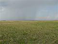
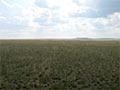
и последние километры пришлось пробираться прямо по степи. Прошёл небольшой
дождь, и для нашей машины это стало серьёзным препятствием. В одном месте
пришлось даже выталкивать автомобиль из колеи.
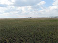
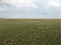
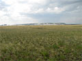
Точка расположена в 7,0км восточнее посёлка Ясный. В 1,4км находятся отвалы
ближайшего асбестового карьера, а в 5,0км видны строения комбината "Оренбургские
минералы". Здесь добывают хризотил-асбестовое волокно - "горный лен".
Очень интересно выглядят карьеры на космоснимках в "Google".
Возвращались на асфальт вдоль карьеров в сторону комбината. Дороги плохие,
но проехать можно. Далее мы отправились к посёлку Светлый, к точке 51°N 61°E.
28-Aug-2009 – From the confluence 51°N 59°E we drove towards Yasnyy settlement. The complication of the approach to 51°N 60°E is that the way from Yasnyy settlement is blocked by quarries. Usually these territories are safeguarded and they have limited entrance. We got lost a little bit so we missed our turn. But we did it fortunately enough; having passed Elenovka village, we turned onto a dirt road which led to the confluence from the east. Soon the road terminated so we had to overcome the last kilometers straight through a steppe. It had been raining so it became a serious obstacle for our car. One time it was a necessity to extract our car from the deep rut.
The confluence is located in 7 km to the east of Yasnyy settlement. There are dumps of the nearest asbestos quarry at 1.4 km distance as well as buildings of the plant named as “Orenburg minerals” are visible in 5 km distance. Here chrysotile is mined. Chrysotile is a kind of asbestos thread, or amianthus. The quarries are interesting to observe in Google Earth service.
We were coming back to an asphalt road along the quarries towards the plant. Roads are dilapidated but it's still possible to drive. Further on we went to Svetlyy settlement, towards the 51°N 61°E confluence.
Отчёт о походе читайте ЗДЕСЬ.
Фото из похода ЗДЕСЬ.
Пишите на |
||